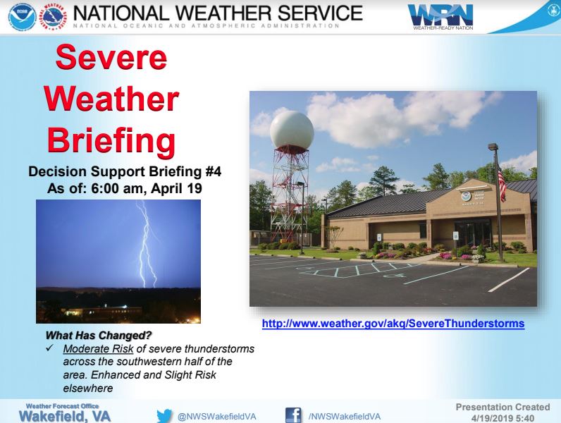
Click Here to Download the Full Briefing on the Severe Weather Alert >
VDEM Region 1 - Situation Report #2
A band of severe thunderstorms began impacting region 1 localities late this morning and continued through early afternoon resulting in heavy rain and windy conditions. Region 1 localities continue to be under an enhanced threat of severe weather for the remainder of the evening into overnight. Much of the region is currently under a tornado watch or warning. A flash flood watch remains in effect for all region 1 localities and a second band of severe thunderstorms are expected to begin impacting the region between 6-8 pm this evening. This second band of storms could produce tornadoes, hail, flash flooding, and winds in excess of 60 mph.
The Region 1 Office continues to monitor locality situation reports, open source media, and weather outlets in addition to communicating with NWS Wakefield as needed.
Main concerns for Region 1 localities include the potential for tornadoes or straight line wind damage, large hail, downed trees, flash flooding, and power outages.
State actions include:
Virginia Department of Emergency Management (VDEM)
- VDEM Region 1 RCC Status: Virtual/Monitoring
- RCC1 Requests for Assistance
- Active: 0
- Complete: 0
- Withdrawn: 0
- RCC1 Requests for Assistance
- VDEM VEST/VEOC Status: The VEST/VEOC is at Condition Yellow (Increased Readiness). Coordinating situational awareness with other State Agencies and partner organizations.
- VDOT: Road conditions are good, but congested with heavy holiday traffic.
Institutes of Higher Education (IHEs)
- Virginia Commonwealth University (Richmond City) – cancelled classes after 1600hrs. VCU Medical Center is open and operational.
- Virginia State University (Richmond City) – closed as of 1200hrs
Department of General Services (VDGS)
- Capitol Square is closed to the public as of 1300hrs today until further notice due to potential weather related hazards.


 Made in the U.S.A.